2017 Project News
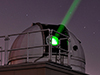
 SGP provides tour of GGAO during NASA Social Media Day, November 3, 2017
11/20/2017As part of NASA's Social Media Day, held November 3, 2017, the Space Geodesy Project provided a tour of the Goddard Geophysical and Astronomical Observatory (GGAO) to 50 social media users selected by NASA. View scenes from the tour, courtesy of Conner Sebreny.
 New release of the calc/solve analysis package available
11/17/2017The NASA GSFC VLBI Group is pleased to announce a new release of the calc/solve analysis package. This release fixes several bugs and offers better support for vgosDB. It also allows the user to use a model for galactic aberration. For questions, contact (sergei.bolotin@nasa.gov) Dan MacMillan (Daniel.s.MacMillan@nasa.gov), or John Gipson (john.m.gipson@nasa.gov).
 CDDIS Computer System Outage will affect SGP website
11/15/2017CDDIS must undergo an unplanned outage on 16-Nov-2017 from 14:00-18:00 EST (19:00–22:00 UTC) to replace critical system hardware. Because the SGP website is hosted on the CDDIS server, there may be extended interruptions in connectivity to the SGP website during this period. We expect that the system outage will not require the full 4 hours but have allocated time to address any unforeseen issues.
We apologize for any inconvenience these outages may cause the user community.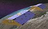 GRACE mission ends science operations
10/27/2017After more than 15 productive years in orbit, the U.S./German GRACE (Gravity Recovery and Climate Experiment) satellite mission has ended science operations. During their mission, the twin GRACE satellites have provided unprecedented insights into how our planet is changing by tracking the continuous movement of liquid water, ice and the solid Earth.
 Read more
- Interruptions in network connectivity to SGP website
10/27/2017The CDDIS network will undergo maintenance on Tuesday, October 31, 2017 between 15:00 - 19:00 UTC. Because the SGP website is hosted on the CDDIS server, there may be extended interruptions in connectivity to the SGP website during this maintenance period but we expect only short 5-10 minute outages during the timeframe.
We apologize for any inconvenience these outages may cause the user community.  Chopo Ma retires
10/01/2017After a very long and distinguished career in VLBI, Chopo Ma has retired from NASA, effective September 30, 2017. We wish Chopo the best for the next stage in his life. With his retirement, Frank Lemoine has been named the new Space Geodesy Project Scientist.
 Seventh Session of the United Nations Committee of Experts on Global Geospatial Information Management (UN-GGIM) was held on August 2-4, 2017.
08/11/2017Seventh Session of the United Nations Committee of Experts on Global Geospatial Information Management (UN-GGIM) was held on August 2-4, 2017 at the United Nations Headquarters in New York, preceded by a number of related side events on July 31 through August 1, 2017. The meetings brought together senior officials and executives from national geospatial information and statistical authorities within Member States, and international geospatial experts from across the globe. An important outcome of this session was the establishment of a Subcommittee on Geodesy to provide stability and longer-term planning for the Global Geodetic Reference Frame (GGRF). Participating from NASA’s Space Geodesy Program were: Benjamin Phillips (NASA/HQ), Stephen Merkowitz (NASA/GSFC), and Allison Craddock (NASA/JPL) as US Delegates, and Michael Pearlman (Smithsonian Astrophysical Observatory) as a representative of the International Association of Geodesy.
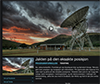
 NASA, Norway to Develop Arctic Laser-Ranging Station
08/07/2017NASA and the Norwegian Mapping Authority are partnering to develop a state-of-the-art satellite laser ranging station 650 miles from the North Pole that will produce high-precision locations of orbiting satellites, help track changes in the ice sheets and improve the efficiency of marine transportation and agriculture.
Under the new agreement signed on Aug. 7, Norway and NASA will build and install a satellite laser ranging facility in the scientific base of Ny-Ålesund, Svalbard. NASA will also provide expert consultation on how to operate the instruments. The ground-based laser transmits ultrashort laser pulses aimed at satellites specially equipped with a retroreflector, an array of special mirrors that bounce the pulses back. The system measures the time it takes for the light to travel back to its point of origin, which is used to determine the position of the satellite with respect to the ground station with an accuracy of around 0.04 inches (1 millimeter).
View photos from the signing ceremony.
Read more
 CDDIS has been accepted as an Earth Science Information Partners (ESIP) Type 1 member
08/04/2017CDDIS is pleased to report that it has been accepted as an Earth Science Information Partners (ESIP) Type 1 member, joining over 180 partner organizations that include many of the other NASA DAACs. ESIP is a non-profit, volunteer and community-driven organization that advances the use of Earth science data through meetings and virtual collaborations around topics such as data stewardship, information technology and interoperability, and application areas like disaster response, climate, energy and agriculture. Type 1 members are distributors of satellite and ground-based data sets and the products derived from these data.
 2017 ILRS Technical Workshop: Second Circular
07/21/2017The Institute of Astronomy at the University of Latvia and the International Laser Ranging Service (ILRS) will host the 2017 ILRS Technical Workshop on October 02 through 05, 2017 in Riga, Latvia. The second circular, containing important information about upcoming deadlines, is now available. The first circular for the workshop was issued in February 2017 and contains information about the workshop topics.
 Printed version of the Journal of Geodesy Special Issue on VLBI now available
06/21/2017The printed version of the Journal of Geodesy Special Issue on VLBI: Journal of Geodesy, Volume 91, Issue 7, July 2017, is now available at https://link.springer.com/journal/190/91/7/page/1. This volume includes a Preface and 14 scientific articles devoted to various aspects of the VLBI theory, methodology and data analysis.
 Dr. Bill Petrachenko receives Career Service award
06/15/2017Dr. Bill Petrachenko from NRCan has received a Career Service award from Canada’s Department of Natural Resources. More information is available on the NRCan website.
- June 08, 2017 was a significant anniversary for VLBI
06/09/2017In 1967, three groups -- one Canadian, another a collaboration between the National Radio Astronomy Observatory (NRAO) and Cornell University, and a third at MIT and Haystack Observatory -- were each working to achieve the first VLBI observation.
Fifty years ago today, on June 8, 1967, one of the first such experiments was successfully carried out between Haystack and NRAO (see attached figure). In 1971, the American Academy of Arts and Sciences awarded its Rumford Prize to members of all three groups. The MIT and Haystack recipients were J.A. Ball, A.H. Barrett, B.F. Burke, J.C. Carter, P.P. Crowther, G.M. Hyde, J.M. Moran, A.E.E. Rogers.
 Innovation column in GPS World discusses importance of laser ranging to GNSS satellites
05/25/2017In the May 2017 Innovation column of GPS World, author Urs Hugentobler discusses the importance of laser ranging to GNSS satellites for improvement in modeling the orbits of these satellites. Better GNSS satellite orbits result in better receiver position accuracies, which are required to improve monitoring of Earth processes.
 NRK TV (Norway) features the need for a precise Terrestrial Reference Frame, and discusses role of NASA and the Space Geodesy Program
04/14/2017NRK TV in Norway has published a video feature (in Norwegian) discussing the importance,and challenges of global cooperation in making precise measurements to support the maintenance of an international terrestrial reference frame necessary for natural hazard and global change studies. The video also discusses the future plans for cooperation with NASA in the construction of the geodetic station in Ny Alesund. The video features interviews (in English) with SGP Manager Stephen Merkowitz (Code 61A @ NASA GSFC; time index 5:26, 8:45, 10:20) and colleagues Hayo Hase (AGGO, La Plata Argentina ; time index 11:14 20:07) Ludwig Combrinck (HartRAO, South Africa; time index 6:24, 17:24); Per Erik Opseth, Laila Lovhoiden, Gary Johnston (Geoscience Australia, time index 20:53, 23:05), and others, as well as a visit to NASA GSFC and GGAO.
 Upcoming maintenance on CDDIS and ILRS email exploders
04/14/2017The NASA system used for CDDIS and ILRS email exploders will be undergoing maintenance from 13:00 - 17:00 UTC on April 23.