Videos
Educational/Informational
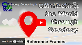
Geodesy: Connecting the World Through Geodesy: Terrestrial Reference Frames
07/29/2024
The GGOS (Global Geodetic Observing System) Coordinating Office has released a 2.5-minute short film highlighting the critical role of geodetic terrestrial reference frames. This video is primarily aimed at the general public and has been produced in collaboration with the UN-GGCE (United Nations Global Geodetic Center of Excellence).

Terrestrial Reference Frames: Connecting the World Through Geodesy
07/29/2024
The GGOS (Global Geodetic Observing System) Coordinating Office released a 10-minute film highlighting the critical role of geodetic terrestrial reference frames in September, 2023. This video is primarily aimed at the general public. The video is available in multiple languages, and has been viewed over 40,000 times since its release.
Go to YouTube to access the video in languages other than English.
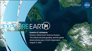
The critical role that geodesy and the global observatories play in Earth observation
08/02/2022
Dr. Karen St. Germain, the Earth Science Division Director at NASA Headquarters, presented "the critical role that geodesy and the global observatories play in Earth observation" at the Twelfth Session of the United Nations Committee of Experts on Global Geospatial Information Management.
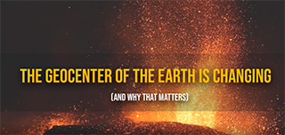
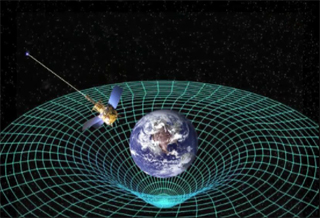
The Geocenter of the Earth is Changing (and why that matters)
04/13/2022
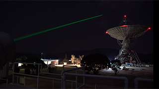
At the foundation of virtually all airborne, space-based and ground-based Earth observations is the TRF, or Terrestrial Reference Frame. The TRF relies on an accurate calculation of the geocenter of the Earth (the center mass of the Earth). However, one complication is that the geocenter is constantly changing with respect to the Earth's surface. By using a network of ground stations equipped with telescopes and lasers that fire pulses at specific satellites, scientists can calculate where the geocenter of the Earth is at any given time to a few millimeters to ensure our Earth observations are accurate.
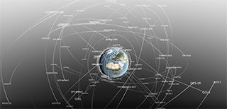
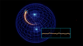
Data Visualization of Earth's Geocenter Motion
04/13/2022 The visualization begins with most of the satellites used and directly supported by SGP. The view then moves to the surface of the Earth, showing the positions and direction of the motion of geodetic stations which define the International Terrestrial Reference Frame (ITRF). It then zooms into the center of the Earth and shows the relative movement of the Earth's center of mass, i.e the geocenter (ITRF origin).
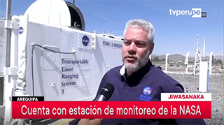
SGP Project Manager Stephen Merkowitz interviewed by TVPerú at Arequipa SLR station
05/31/2019
SGP Project Manager Stephen Merkowitz was interviewed by TVPerú in Spanish for a story on the NASA Satellite Laser Ranging Station TLRS-3 in Arequipa, Peru that aired on TVPerú Noticias. A version of the story was also aired in Quechua.
Quest for the Exact Position
03/16/2019
Norwegian documentary. The future will give us driverless cars and remote surgeries. This technology demands precision at a millimeter level. The UN encourages all nations to join the quest for the exact position. This work will ensure a safe technology, better navigation in rescue work, and a higher precision for measuring the effects of climate change.
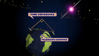
Using Quasars to Measure the Earth: A History of VLBI
06/21/2012
VLBI, or Very Long Baseline Interferometry, is a technique that uses multiple radio telescopes to very precisely measure the Earth's orientation. It was originally invented back in the 1960s to take better pictures of quasars, but scientists soon found out that if you threw the process in reverse, you could measure how the ground beneath the telescopes moves around, how long days really are, and how the Earth wobbles on its axis as it revolves around the sun!
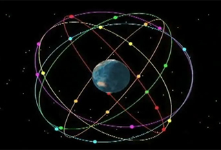
NASA Pinning Down "Here" Better Than Ever
02/23/2012
NASA is helping to lead an international effort to upgrade the four systems that supply crucial location information in pinpointing where "here" is.
Earth Orientation Animations
03/01/2013
When you think of the Earth’s orientation, you’d probably imagine something like a globe, where it always rotates around an axis, called the spin axis, defined by the north and south poles. And while this generally makes sense, in reality, the Earth’s orientation is constantly changing very slightly, and this change can be described in three ways. Learn more about how the Earth's orientation changes by watching these animations.
Satellite Laser Ranging (SLR) and Pi
03/14/2013
Satellite Laser Ranging (SLR) and Pi? Check out this podcast to learn how SLR is using pi to determine the effective reflective surface area of retroreflectors!
On Target With GPS
12/16/2010
Learn more about GPS and how it works in this video produced by NASA and Air Force Space Command.
Events
NASA Social Media Day - November 03, 2017
11/03/2017
Scenes from the GGAO tour at GSFC on NASA's Social Media Day
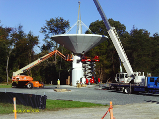
Time-lapse video of VLBI2010 Installation at GGAO
08/14/2012
Time lapse video showing the construction of the VLBI2010 antenna at NASA Goddard Geophysical and Astronomical Observatory GGAO, September 15 through October 12, 2010.